
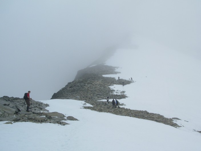
Gjende Lake; Besseggen Ridge (with people), 200 m drop, looking down (click on photos to enlarge)
Jotunheimen is unique. It is a very large area for hiking, has excellent huts run by DNT and private lodges. They are all very clean, with excellent food and all you need to bring is a liner. The trails are very scenic and mostly above the tree line. The only disadvantage is the common rain, for about one or two hours a day, often starting around 16.00 h.
In July you have very long day light as it only gets dark between midnight and 3.00 h in the morning. You also have the many scenic snow fields which make walking easier but gets your boots wet.
This was my first time in Norway. Norwegians are very friendly and surprisingly relaxed, even pleasantly shy. This so unlike current Western Europeans which tend to be very tense, running after the ever more expensive Euro or Pound. A land with a length of 2000 km and with only 4 million people, this is the rural countryside spirit.
Jotunheimen
The area is 300 km North of Oslo and the most popular hiking area of Norway. The area has many luxurious full service and equipment huts. It has several of the highest peaks in Norway which are mostly straightforward trekking peaks. A one week tour takes you through only half of the area but is sufficient to appreciate the scenery, a mountainous glacial landscape. If you watch carefully, you will even see lemmings, our little brothers from the Arctic. In July the ground is still wet by the spring run off and there are still many snow fields. We saw very few mosquitoes but this may change in August..
Equipment
A major hindrance is the wet weather, comparable to Scotland, the South Island of New Zealand or Patagonia. Fortunately, Jotunheimen get less rain, mostly light drizzle. “All Gore”-Tex coat, pants, boots and even gloves are still a must but will keep you dry for 1 or 2 hours only. Leeks and sweeting will get you wet. The main purpose of Gore-Tex gear is to keep you warm, essential at the common 10-12 degrees Celsius at 1200 to 1700 m, and prevents you from getting completely soaked. Snow gaiters with a wide base prevents the water running into your boots as the coverage of the boots is better compared to light weight, straight, wet grass/dirt gaiters.
Snow fields stay well into July and make your boots very wet so you need Gore-Tex lined boots and walking sticks which are also useful for crossing the many streams in July and walking on boulder areas. Ice picks are not necessary. Walking on rocks is tricky, especially large boulders as they are covered by slippery moss and lichen. All rocks should be assumed slippery. After a few slides you learn fast and walk like a ballet dancer, very upright. Ski poles are again useful else you run a risk hurting your ankles and knees. One full slide a day and several half slides are still common despite the ski poles..
The rucksack must have a waterproof liner inside as a rain cover is insufficient. In heavy rain you should also use a rain cover. 4-7 hours of running water and pools of water inside a ruck sack will eventually makes its way through so-called waterproof closures as was our experience in New Zealand.
When you camp and need Primus gas, the shopping center above the Central Train Station in Oslo has a giant sport store with camping equipment. Full service huts also tend to sell Primus Gas. Note that it is not allowed to carry Primus gas on the plane.
Access
The classic 7-day route called the “Gjende Lake Route” starts in Gjendesheim, a small tourist hamlet, but how to get there? Before we left, this remained a mystery as many buses do not run daily.
Most websites tell you to spend the night in Oslo but when you arrive in time you could go on to the mountains like to Fagernes, which is only 3 hours by bus.
There is a very good website, www.rutebok.no, for transportation in Norway. This has detailed information on all the good connections. You must activate "connections" to see the detailled schedule and you need this information when hopping quickly on the bus where you pay the fee to the driver.
There are so many on-ward connections that the bus information stand at the airport could not help us and we missed the 17.05 h bus to Gjøvik with an onward connection to Fagernes. Now we had to wait 4 hours for the 21.00 h bus from the Oslo Bus terminal to Fagernes arriving close to midnight, 3.5 hours delayed. From Fagernes there is a morning bus at 8.00 h to Gjendesheim, arriving at 9.20 h. you still have a full hiking day.
Some connections to go to Gjendesheim from the Oslo bus terminal:
9.00 h from the Oslo busterminal to Gjendesheim, arrival 14.20 h.
17.05 h Line 26-131 from the aiport to Gjøvik and 18.40h Line 05-301 on to Fagernes, arrival at 20.29 h. Next day 8.00 h to Gjendesheim.
13.05 h from the Oslo busterminal to Fagernes, arrival 16.18 h. Next day 8.00 h to Gjendesheim..
17.00 h from the Oslo busterminal to Fagernes, arrival 20.00 h. Next day 8.00 h to Gjendesheim.
21.00 h from the Oslo busterminal to Fagernes, arrival 23.52 h. Next day 8.00 h to Gjendesheim.
Day 1. Gjendesheim-Glitterheim. 8 July.
7 hours net walking, not counting rests. 18 Celsius. Intermittent rain after 15.00 h, heavy rain at 18.30 h. Rocky trail above the tree line, several wet and muddy spots.
Most hikers that start in Gjendesheim go along the Besseggen Ridge to Memurubu, the most popular day trek in Norway. Some 30000 people do this every year.
We took the very quiet direct route to Glitterheim and met only 10 persons, most on the half-way point on the lake shore of Lake Russvatnet [1]. They were going to Gjendesheim.

Russvatnet Lake
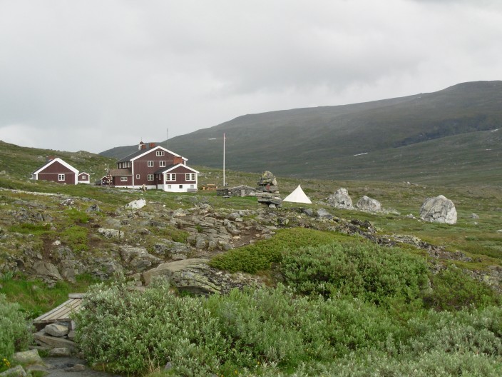
Glitterheim Hut
The Glitterheim hut [1] has many rooms and a dormitory. It was founded in 1901. It is accessible by a dirt road and you see day-trippers on mountain bikes.
Day 2. 9 July. Rest day or up Glittertinten (2466 m). 9 July.
Light rain most of the day except between 13.00 and 15.00 h.
Today is one of those rainy days in Jotunheimen. Most hikers go out anyway, the Japanese (or Koreans) first. They go to Spiterstulen, a 5 hour trip. Only one person, my companion, goes up to the second highest mountain in Norway, the Glittertinten with an altitude of 2466 m. This is an easy 2.5 hours up. The next day lots of young children in the age of 8-12 years also go up [1]. The top of Glittertinten is covered by a glacier and you walk on blue ice.
I stay in, trying to recover from yesterdays cold and enjoying the empty, luxurious mountain hut and the practise session of a classical music group, Fannaraken [1]. They give a concert tonight [1]. In the distance a herd of raindeer settled on snow.
Raindeer on snow. [detail].
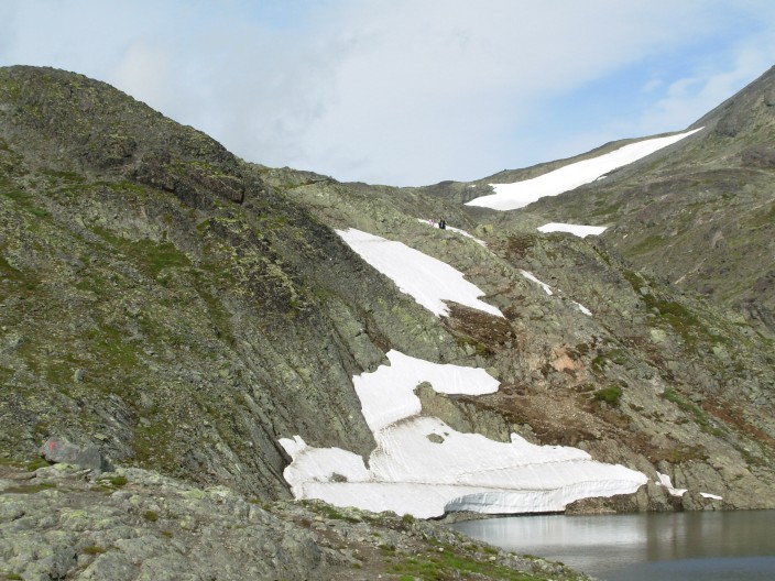
Day 3. 10 July Glitterheim-Spitentulen.
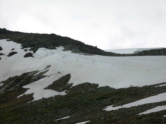
5 hours net walking, not counting rests. 15 Celsius. Intermittent rain from 12.00 to 14.00 h. a Rocky trail [1], barren landscape with lots of snow fields and glaciers [1], many wet spots, a few easy stream crossings. Most of the day we were the clouds. Rain for 1 hour [1]. Glittertint mountain Was never visible. In the valley we spot a mature lemming about 12 cm in size. Young ones are half the size.
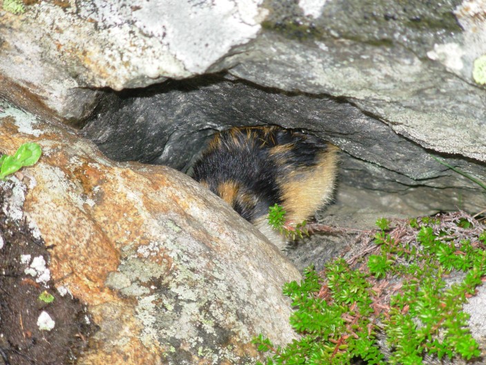
Lemming hiding, face not visible.
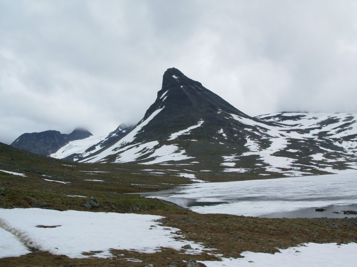
Kautflye Pass between Glitterheim and Spiterstulen, altitude 1600 m.
Rain always started around 15.00-16.00h for the last 4 days. Rain also often at night, untill 9.00 h in the morning.
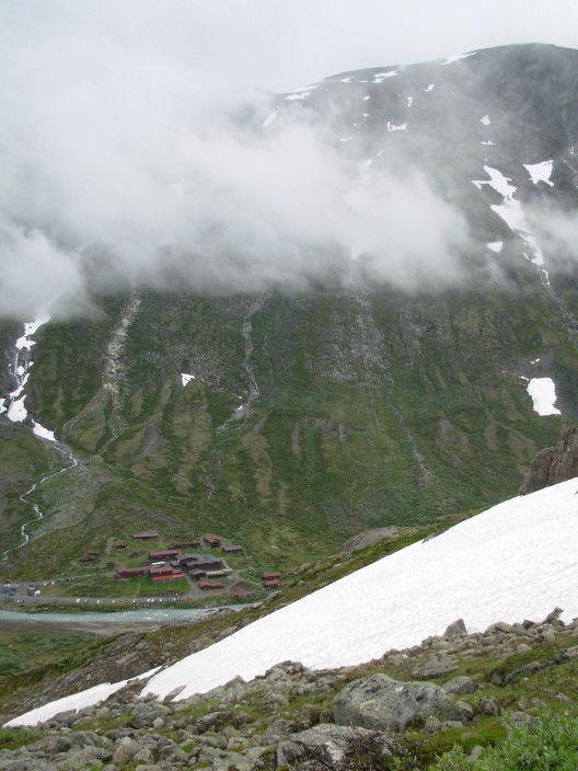
View at Spiterstulen, view from the Galdhopiggen route, from the West.
Day 4. Galdhopiggen. 11 July.
14 Celsius at the top, at 2696 m. Mostly clouds or mist, some light rain.
Hut at the top of Galdhopiggen.
Near the top of Galdhopiggen (2669 m), the highest mountain of
Scandinavia.
This is the highest peak of Scandinavia with 2469 m. From Spiterstulen it is a real effort with 1300 m vertical elevation but not very difficult, 6 hours for a round trip for fit people, not counting rests. Some parts are very rocky, with big loose boulders [1].
Route up along a ridge, across big boulders.
Without heavy pack sacks, at high speed, it took us only 2.5 hours up and over 2 hours down. Some 50 Norwegians do this every day.
From Juvashytta the route is much easier, only 500 m up, but you have to cross a glacier with potentially crevasses. Some 500 people do this route every day, keen to reach the highest peak of Scandinavia. They are all roped up, 20 on one rope, young, old, families and the family dog.
At the top there is a small hut that serves hot drinks and even food, very salty sausage.
Today it was 14 Celsius on top, mostly cloudy and we often were in the mist.
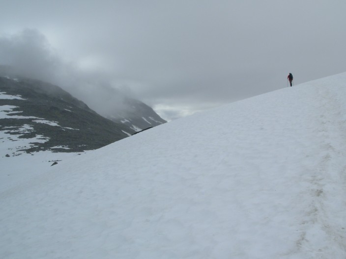
On the way down, running down the snow fields [1] was much easier then walking on the large boulders.

Snow slay, watch the hidden rocks.....
Even more fun is slaying on snow on your bum using the Gore-Tex rain pants except when you hit hidden rocks and hurt your tail bone (cloink) like my companion did.
Finally we have a clear view East and see the mountain of Glittertinten (2666 m) [1] and the route we followed yesterday.
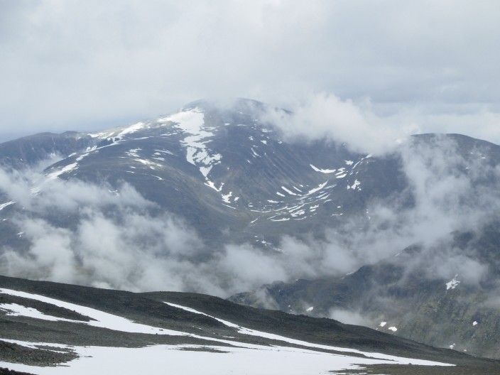
Glittertinten, mountain on the left side, 2666 m
Day 5. To Leirvassbu. 12 July
Mostly cloudy, rain till 9.00 h, some light rain during the day.
On the pass we see a herd of raindeer. They are barely noticeable by the brown camouflage colour. We didn't see them until we heard the snorting noise.
Raindeer at the pass close to Leirvassbu. Click on photo to enlarge. [Detail].
We saw several hanging wall glaciers near the top of mountains [1].
The Kyrkje Mountain is impressive but we will have not time to go on top. The normal ascent is from the SW along a ridge.
Kyrkja Mountain
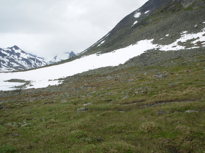
The Leirvarssbu area still has 90% snow cover [1] and near the hotel there is a meter of snow [1]. The hotel has been built in an Alpine lodge style perhaps already a 100 years ago using carved wooden beams. The open lounge and dining area has an atrium and looks very spacious. It has nice views at Kyrkja [1]. Some rooms have a bath.
Day 6. To Memurumbu.
15 Celsius, rain till 9.00 h, some sunshine, second day with no rain after 15.00 h.
From Leirvassbu to past Kyrkja there are lots of snow fields [1] and we start walking in low hanging clouds, just after the rain stopped. In this area snow only disappears very late in the summer.
Snow fields close to Leirvassbu and before Kyrkja (left).
The official route up to Kyrkja [1] starts after a 30 minutes walk. It would take about 3-4 hours to go up and down the mountain.
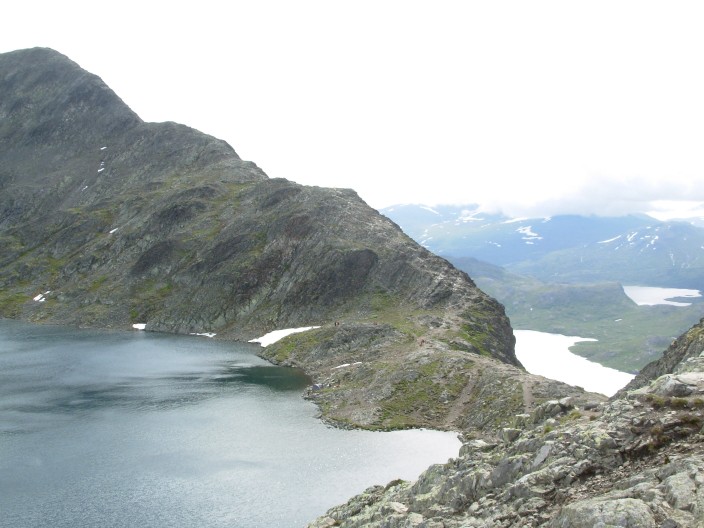
We walk along the Langvatten Lake [1] , the shortest route to Gjendebu, but most hikers (4) continue to the next hut at Olavsbu and have to cross a relatively deep stream.
The last 7 km we have lots of non-biting flies on the shore of a lake. We pass a waterfall and have to go down a steep snow field [1] [detail].
Reaching Gjendebu at 15.55 h we thought we were in time for the boat but this leaves 10 minutes or some 700 m further down the lake. A run carrying full packs gets us in time for the boat with 2-3 minutes spare. Norwegian boot and bus schedules are precise.
Day 7. Memurubu to Gjendesheim.
12 Celsius on top, windy, feels cold. 16 Celsius at the lake. Usual rain at 15.00 h. 4.5 hours net walking at good pace.
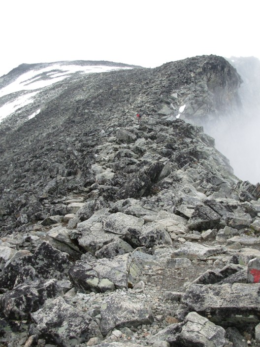
Besseggen Ridge, some 200 m of 3rd grade rockclimb, never difficult.

Besseggen Ridge, some 200 m of 3rd grade rock climb, but .... the route looks impressive, like any ridge walk.
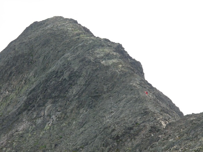
Besseggen Ridge, some 200 m of 3rd grade rockclimb, but .... it looks like a challenge.
Besseggen Ridge, the only tricky spot near the lake by the July snow field.
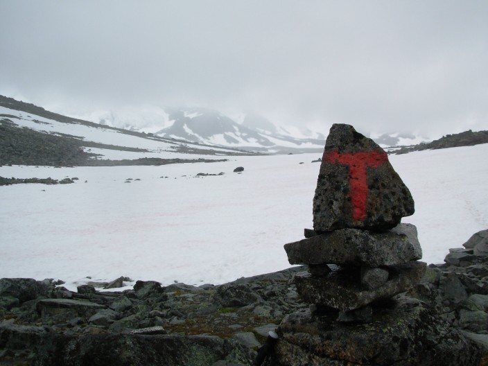
A ridge walk along Besseggen [East Side route] [detail route East Side] [view West lake] [East View lake] . This is a grade 3 rock climb [1], never very difficult and no dangerous drops except for one steep snow field and rock face West of the upper lake [1] . Some 500 – 1000 people do it every day, including small children and the family dogs.
Many will need the 7-8 hours and arrive between 16.00 and 17.00 hours. Rain started today at 15.00 h and was heavy. Many slow walkers will have gotten wet (and cold) today.
We arrived at 13.30 h, in time to take a shower in the DNT hut and catch the 15.15 h bus back to Oslo. During the drive to Oslo, we had heavy rain. Lakes and rivers were high.
You are visitor #
![]() since August, 2006.
since August, 2006.
![[1]](07no3188kids.jpg)
![[1]](07no3169fanaraggen.jpg)
![[detail].](07no3158raindeerdetail.jpg)
![[1]](07no3201passveslglupen.jpg)
![[1]](07no3204veodalen.jpg)
![[1]](07no3282snowrun.jpg)
![[Detail].](07no3334raindeer.jpg)
![[1]](07no3324glacier.jpg)
![[1]](07no3363leirvassbu.jpg)
![[1]](07no3366leirvassbu.jpg)
![[1]](07no3369kyrkja.jpg)
![[1]](07no3374kyrkjaroute.jpg)
![[1]](07no3385langvatnet.jpg)
![[1]](07no3396waterfall.jpg)
![[detail]](07no3398waterfall.jpg)
![[East Side route]](07no3419besseggen.jpg)
![[East View lake]](07no3426gjende.jpg)